Garigal National Park is just 20 km away from the Sydney CBD and provides many tracks popular with both hikers and mountain bikers. We did not do much homework on which track to follow and decided to play it by the ear and ended up following the track from Flat Rock Beach to Davidson Park.
One thing we did not realize is how big the Garigal NP is. It is 2000+ hectares irrespective of being so close to the CBD. I thought when the destination was set as Garigal NP, the GPS would direct us to the main entrance from where all different tracks start. That was proved to be wrong. GPS first took us to an entry to a track, but we were not convinced it is the right destination. We again drove back to the main road and then GPS directed us to the end of Killarney Drive. We decided to follow the bush track that started from there. If you are planning to visit the Garigal NP, it is better to do a bit of research on which track to follow and find the track entry point beforehand.
The track started winding down through the bush and had some wooden steps at places. Soon we came to an intersection between Flat Rock Beach Track and the Magazine Track and decided to follow the Magazine track. About 20 mins walk, including time for photographs and time for deciding which track to follow, got us the Flat Rock Beach. Beach is named so as it is created by sand that is deposited on a flat rock. We had the small secluded beach to ourselves.
 |
| Davidson Park |

 |
| Approaching Flat Rock Beach |
 |
| The Flat Rock Beach |
Just a few meters from Killarney Drive, there was a small waterfall trickling down the rock platform. It may have looked much better after a rain. You get a good view of it from Flat Rock Beach.
We continued on the Magazine track which was winding through the fern undergrowth. Magazine track is a 6.8 Km return walk and did not have many highlights on the way. So after few meters, we decided to turn back.  |
| Views of the Flat Rock Beach from Magazine track |
 |
| Ferns along the Magazine track |
 |
| Climbing the steps back towards Killarney Drive |
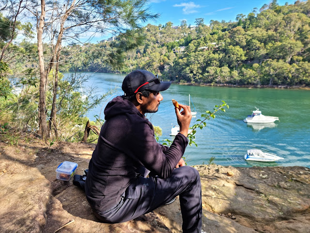
This time we decided to follow the Flat Rock Beach track towards Davidson Park. It was a lovely walk through the bush with views of the Middle Harbor. We had the track to ourselves up until we reached Davidson Park. It was a relatively easy walk and took us a little over one hour to get to the park.
 |
| Views of the Middle Harbor from Killarney Drive |
The weather was ideal, the views were great and Davidson Park was lovely. We had an enjoyable day. However, I felt we could have planned the day better. Then again, there is fun in unplanned adventures when you don't know where the track leads you to. We need to come back to explore Garigal National Park again as only the surface was scratched today.


Comments
nice place to visit after the long
lock down.��♂️��♀️